Hastaraj Pandey
5+ Years
Experience

Let's
Introduce About
Myself

A Diploma holder in Geomatics Engineering and Bachelor of Arts (Geography) graduate with strong academic and professional training in GIS, remote sensing, and spatial data analysis. Based in Kathmandu, Nepal.

Experienced in UAV–LiDAR surveys, bathymetric mapping, photogrammetry-based 3D modelling, and geospatial data processing using ArcGIS Pro, QGIS, Pix4D, and Python workflows. Interested in integrating machine learning and advanced remote sensing to study land surface dynamics.

  • NameHastaraj Pandey
  • Emailhrpandey2022@gmail.com
  • Phone+977 9861397358
  • LocationKathmandu, Nepal
  • English●●●● Proficient
  • Nepali●●●● Native
Contact Me

Technical Skills

Core competencies built through 5+ years of hands-on field work and geospatial data processing across Nepal's most demanding terrain.

ArcGIS Pro / QGIS / Global Mapper95%
UAV & LiDAR Processing (LiDAR360, FARO Scene)92%
Pix4D / Agisoft Metashape / DJI Terra90%
ENVI / Remote Sensing / SAR / Sentinel-285%
Bathymetric Survey (RTK Echo-Sounder)88%
DGPS / RTK-GNSS / Total Station / Theodolite95%
Python / Geospatial Workflows70%
5+ Years Surveying Experience in Nepal

Call Me Now

+977 9861397358

Email

hrpandey2022@gmail.com

Location

Kathmandu, Nepal

Service Offers

Professional geospatial services for engineering, infrastructure, environmental, and heritage projects across Nepal and beyond.

🗺️

GIS Analysis & Mapping

Spatial analysis, base map production, geodatabase preparation, and cartographic outputs for engineering and planning workflows.

🚁

UAV & LiDAR Surveys

End-to-end drone and LiDAR data acquisition, point cloud processing, DEMs, DTMs, and orthomosaics for infrastructure projects.

🌊

Bathymetric Surveying

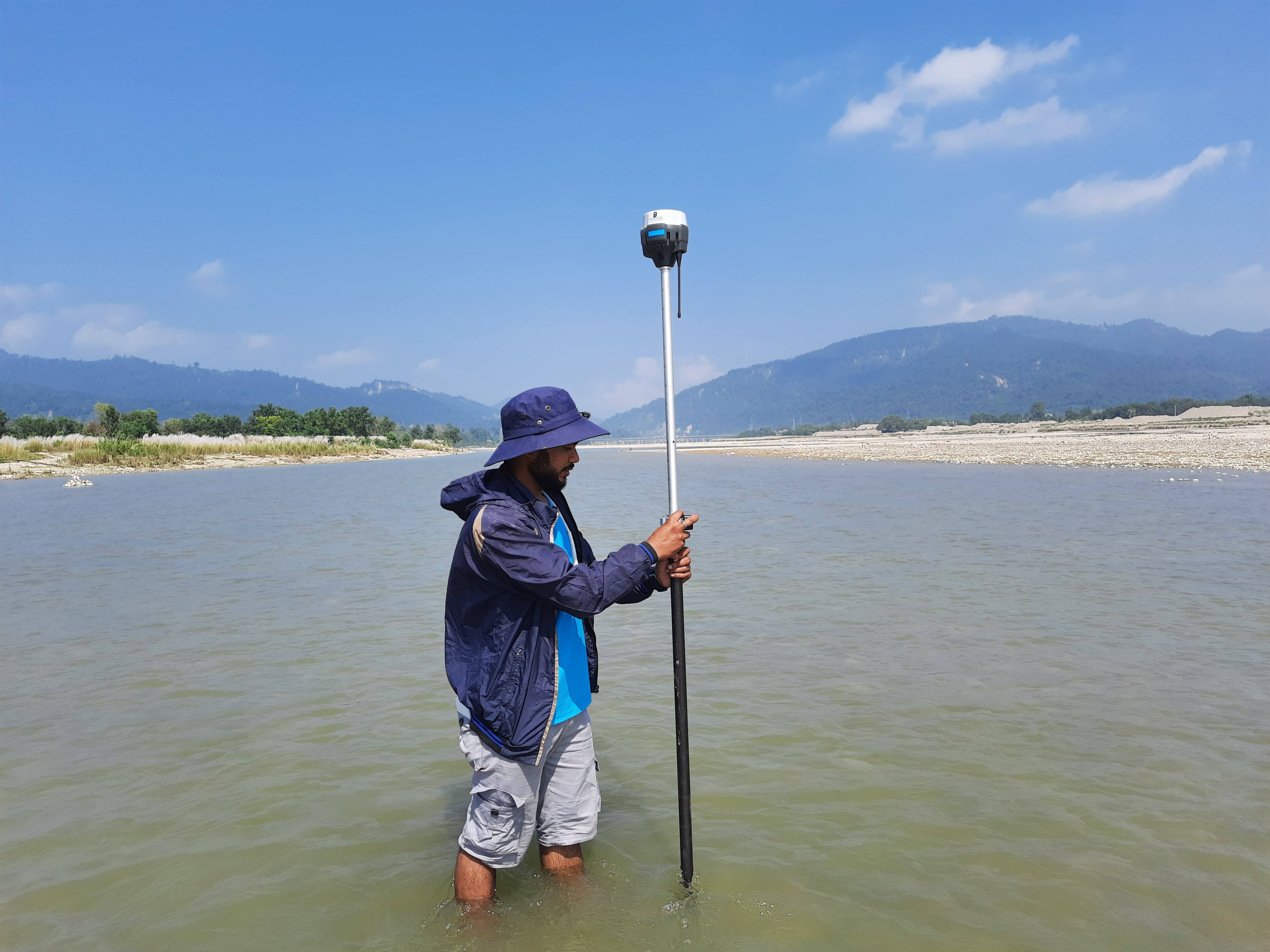
High-accuracy underwater terrain mapping using RTK echo-sounding for lake, reservoir, and riverbed characterisation.

📡

Remote Sensing & AI

Multispectral, hyperspectral, and SAR processing for land cover classification, change detection, and landslide susceptibility.

🌧️

Flood Risk Studies

GIS-based runoff analysis, floodplain mapping, catchment delineation, and risk zoning for infrastructure site planning.

🏛️

3D Heritage Docs

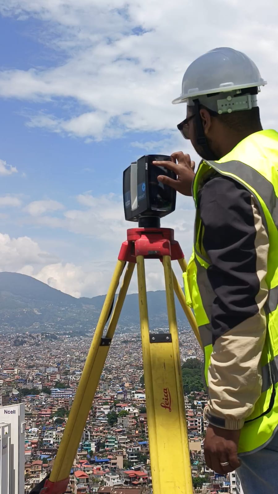
Terrestrial laser scanning (TLS) for high-precision 3D documentation and digital preservation of heritage structures.

📐

Topographic Mapping

Production of high-resolution contour maps, terrain models, and topographic deliverables for infrastructure planning.

🛰️

GNSS / Field Surveys

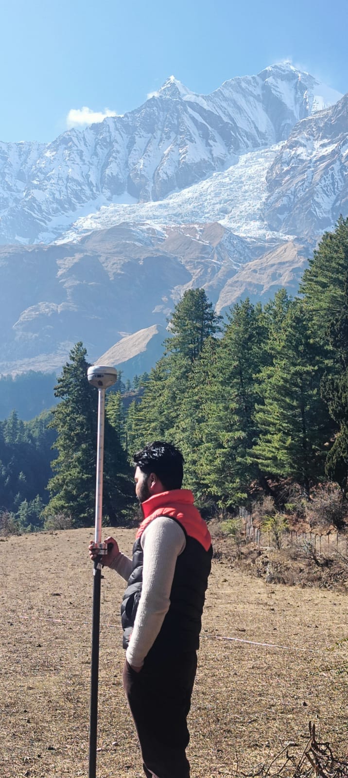
Field surveying using DGPS, RTK-GNSS, Total Station, and Theodolite for precise topographic and hydrographic surveys.

Quality Work
Recently Done Projects

  • All
  • LiDAR
  • UAV
  • Bathymetry
  • Hydrology
  • Heritage
Airborne LiDAR — Sagarnath Forest

Airborne LiDAR — Sagarnath Forest (~280 km²)

LiDAR & Topographic Mapping

±8–12 cm · 30–80 pts/m² · ~280 km²
Airborne LiDARDTM/DSMDGPS GCPsOrthophoto
🗺️

Bagmati Irrigation Project — 900 km² Mapping

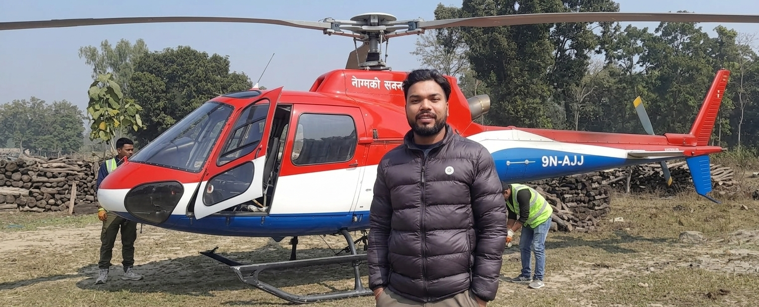
Largest LiDAR Survey
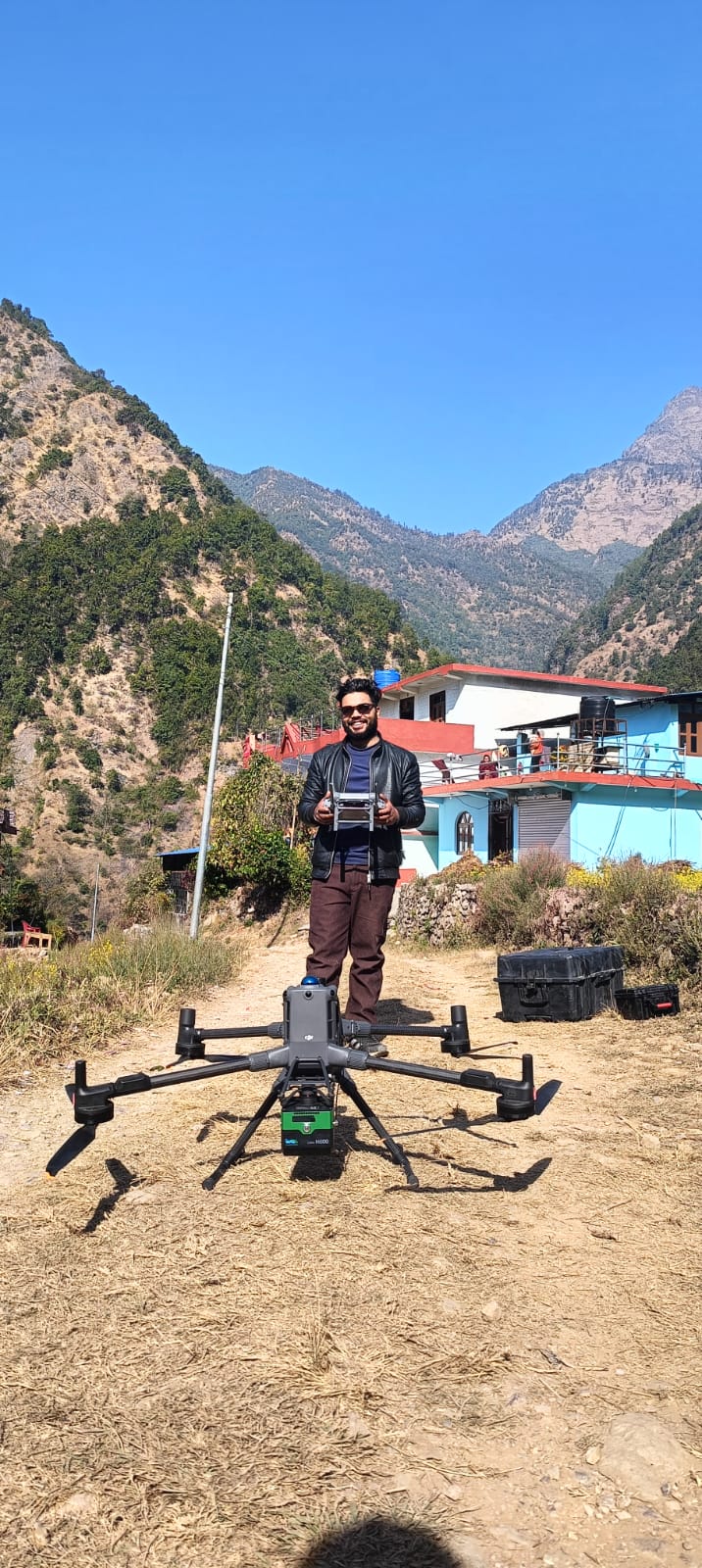
900 km² · PPK Pipeline · RMSE Verified
Airborne LiDARPPKStrip AdjustmentIrrigation
UAV-LiDAR Survey — 50 MW Solar PV, Rolpa

UAV-LiDAR Survey — 50 MW Solar PV, Rolpa

UAV & LiDAR Survey

DJI M300 RTK · H600 LiDAR · DJI Terra
UAV LiDARLiGeoreferenceLiDAR360DJI Terra
Bathymetric Survey — Phewa Lake

Bathymetric Survey — Phewa & Kulekhani Lakes

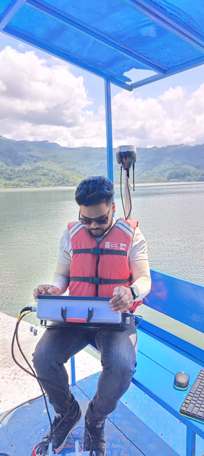
Bathymetry & Sedimentation Study

RTK Echo-Sounder · UAV Fusion
BathymetryRTK GNSSSedimentation3D Lakebed
Flood Risk Assessment — Chandrauta Solar Site

Flood Risk Assessment — Chandrauta Solar Site

Hydrology & GIS Analysis

GIS Hydrology · UAV DEM · Peak Discharge
Flood ModellingGIS HydrologyUAV DEMRisk Maps
3D Heritage Documentation — Krishna Mandir

3D Heritage Documentation — Krishna Mandir (TLS)

Terrestrial Laser Scanning

FARO Focus Premium · FARO Scene · Georeferenced
TLSFARO FocusFARO ScenePoint Cloud

Work Experience

5+ years of field-proven geospatial expertise across Nepal's most challenging survey environments — from helicopter-borne LiDAR to centimetre-precision bathymetric surveys.

Senior Geomatics Surveyor Sept 2019 – Present
Geo-3D Modelling Pvt. Ltd
📍 Kathmandu, Bagmati, Nepal
  • Pre-field planning for every project — risk assessment and safety protocols.
  • Led geospatial mapping projects including bathymetric surveys, topographic mapping, and hydrological assessments.
  • Acquired and processed LiDAR, UAV, and GNSS data to produce high-resolution DEMs, DTMs, and 3D models.
  • Analysed multispectral and radar imagery in ENVI and ArcGIS Pro for land cover mapping, flood modelling, and change detection.
  • Generated topographic maps, 3D visualisations, and technical reports with rigorous quality control.
  • Documented methodologies and prepared technical figures and maps for project reports and presentations.
  • Collaborated with engineers, planners, and architects to apply geospatial insights in projects.
Intern Geomatics Surveyor June 2019 – Aug 2019
Motherland Hydro
📍 Kathmandu, Bagmati, Nepal
  • Collected topographic data using Total Station and DGPS instruments.
  • Layout of Headwork, Pipeline and Powerhouse for the Lekhu Hydropower Project.

Education & Certifications

Academic foundation and professional development in Geomatics Engineering, Geography, and advanced remote sensing techniques.

Academic Degrees

2020 – 2024
Bachelor of Arts (B.A.) — Geography
Tribhuvan University, Ratna Rajyalaxmi Campus
63.35%
2017 – 2020
Diploma in Geomatics Engineering
Land Management Training Center, Dhulikhel, Nepal
65.9%
2015
Secondary Education Examination (SEE)
Pancha Dev Secondary School, Kalikot, Nepal
67.13%

Certifications & Training

🛰️
AI-Supported Landslide Detection & Susceptibility Analysis — Sentinel-2, Land Surface Parameters & Radar Remote Sensing
G.E.O.S Ingenieurgesellschaft mbH · Dept. of Mines and Geology
📡
Training on DGPS and Terrestrial LiDAR Scanner
Geo Three D Modelling Pvt. Ltd
🗺️
ArcGIS, QGIS, Remote Sensing, Drones & UAVs
Geo Three D Modelling Pvt. Ltd
🌍
Global Navigation Satellite System (GNSS) Training / Workshop
Geo Three D Modelling Pvt. Ltd

Let's Work Together

Open to geospatial projects, remote sensing collaborations, GIS consulting, and research opportunities across Nepal and internationally.

Kathmandu, Bagmati, Nepal
✓ Thanks! I'll get back to you soon.